February 21, 2024
New Sightlines with The Photographer’s Ephemeris
A new sightlines update for Pro customers of Photographers Ephemeris makes it easier to plan landscape photography shots.
I like to use a couple of photography apps when planning shoots. My favourite for many years has been PhotoPills. Not just because it’s good for planning, but it also has several other tools, such as depth of field calculators and hyperfocal distance tables. However, one of the issues is that I can’t sit in my home office on a big screen and use the app for planning. Close behind PhotoPills is The Photographer’s Ephemeris, which allows plans to be synched between a desktop tool and the phone or tablet app. This week, some new functionality has just been released for Pro customers of TPE. Sightlines help to make the process of planning landscape shots while sitting in the comfort of your home.
What are sightlines?
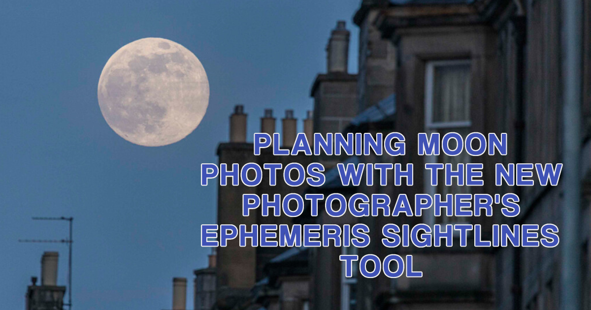
The best way to explain the sightline tool is to describe how it can be used. I don’t know many people who see a full moon rising and don’t look at it in wonder. Look in a newspaper around the date of a full moon, and there will usually be a shot of the moon close to a famous landmark. Rarely will this shot have been taken by chance. The photographer will have planned where they need to stand days in advance to achieve a great shot.
The best moon photos are often taken miles from the landmark (I’ll tell you why later). You must ensure that the position you are standing in has a clear line of sight to the landmark. This is where the new sightlines tool will give a clear visual indication to aid your planning process.
Photographers Ephemeris – an overview
Firstly, the sightlines tool on the desktop version is only available to Pro customers. This means that you will need to pay a small annual subscription. This is because the desktop version uses Google Maps to display the position of shooting points and subjects. Google charges a fee, and the developers pass the costs to subscribers. Once signed up, head to https://app.photoephemeris.com/
If you haven’t used TPE before, the screen below shows an overview of the desktop version. You will be shown a map with a red pin in the middle by default. This is known as the Primary Pin and is used to signify the shooting position. Five lines are shown on the map emanating from the red pin, which signifies different astronomical elements, based on the date selected in the top left-hand corner of the screen.

A – The direction the sun will rise from.
B – The direction in which the sun will set.
C – The direction the moon will rise from.
D – The direction the moon will set.
E – The sun’s direction can be viewed based on the time selected by dragging the timeline at the bottom of the screen.
F – The moon’s direction can be viewed at the same time.
These latter two will disappear if the sun or moon is not visible at the time selected.
Finding the sightlines function
At the moment, the sightlines tool isn’t visible. To use it, you will also need to set a subject location. You do this by activating the secondary pin. On the right-hand side of the screen, click on the black pin icon with two mountain peaks. A black pin (or the secondary pin) is now visible on the map and represents the subject’s position. You can click and drag on either the red or black pin to change the positions.

You may also have noticed that a new panel appeared on the map. This is the new sightlines function, recently introduced to The Photographer’s Ephemeris. Looking out of the window from my office, I can see the Nelson Monument on top of Edinburgh’s Calton Hill. That is what the sightline panel above is showing. There are five elements of the sightlines panel that are important for planning a shoot.

The far left of the panel shows the height of the shooting position. The dark grey areas of the panel are visible from the shooting position. The lightest grey areas are not visible, and the mid-grey areas could be visible, depending on the lighting conditions at the time. On the far right of the panel is the subject location.
Issues with the Sightlines panel
There are a couple of things that stand out from the sightlines view. Firstly, the subject appears as though it shouldn’t be visible from the shooting location. However, I can definitely see the monument from my current position. This is because the standard sightlines panel shows the view from the ground level of the map position of the two pins. My office is on the first floor of the building, so in fact, I am about 6 metres higher than the pin position. Equally, the Nelson Monument is 32 metres tall. We can reflect these in the sightline view by clicking on the blue pencil logo at the bottom of the sightlines panel. A geodetics screen appears where we can offset the height of the two pins.

The position of the red and grey dots on the sightlines panel has been changed to reflect the offset applied. The panel now shows that I should be able to look from my window and see the Nelson Monument. This is where the second issue we must be aware of becomes apparent. The actual view from my office window is below. While I can see the monument, it is because the trees in the foreground don’t have any leaves on them. Give it a few weeks, and I won’t be able to see Calton Hill for the next seven or eight months. The sightlines panel only reflects the view, assuming no trees or buildings are in the way.

Planning a moon rise shot with the sightlines panel
Let’s use the new sightlines panel functionality to plan a full-moon shoot. There will be a full moon this coming weekend, and I would like to shoot the rising moon over Edinburgh Castle. Let’s start by changing the date in TPE to a day when the moon visibility is greater than 99% (in this case, Sunday, 24 February 2024).
Next, we need to place the black pin onto Edinburgh Castle. But remember, the sightlines panel will reflect the ground-level position, so we also need to set the castle’s height. A quick search on Google shows it to be 18 metres above the ground. Equally, we won’t be shooting at ground level – I know my tripod is 1.6 metres tall, so I’ll set the red pin offset to this value.
We now need to know where to stand to see the castle with the moon around it. I’ll start by setting the time on TPE to about 10 minutes after moonrise. We can see the moon’s position on the map relevant to the red pin. Let’s move the red pin to a position that forms a straight line through the subject position and toward the moon position. I have set the position to somewhere on Carricknowe Golf Course in the case below. According to the sightlines panel, I have a clear shot from this position to the castle. We now have an additional blue line on the right side of the panel. This shows us the relative size of the moon from this location. Based on this position, we know the moon will sit atop the castle at 5:41pm – what a great shot! Let’s hope that the clouds stay away!

Wouldn’t it be great to get a bigger moon?
The best moon shots always make the moon appear huge compared to the subject. We can change the moon’s relative size without using Photoshop to cut and paste moon shots. The ‘proper’ way to change the moon’s size is by changing our shooting position. Before we say how to change the position, let’s look at a couple of scenarios. The moon is approximately 384,000 kilometres from the earth. No matter where we stand on the earth, the moon will always be the same apparent size (give or take a few millimetres). Now, let’s think about the size of a building. When you are next to Edinburgh Castle, it appears to be huge. Let’s move a mile away, and the castle appears much smaller. Move another mile away, and it looks even smaller. Combining these two things, we can make the moon appear larger relative to the size of the castle by moving even further away.
Change the map type in TPE to Google Satellite View, and you can see where buildings or trees are. Moving the black pin to a position that keeps the castle aligned with the moon position at Tormain Woods shows that we still have a clear line of sight to the castle. However, look at the size of the relative moon size on the sightlines view. I have adjusted the shooting time to 5:33 to reposition the moon on top of the castle – the moon is huge!

All we need to know now is the lens we need to use to shoot from 12.7km away from the castle. Unfortunately, this is where TPE lets us down. Instead, I will switch to PhotoPills and the field of vision function. Shooting from the Tormain Woods location to the castle with a 600m lens, the shot will include an area from Princes Street gardens on the north side to the National Museum on the south. There is just enough space to show context without the castle being too small. Now, as I said earlier, all we need is a clear sky!
Please give us your feedback.
If you’ve got any questions or comments, leave them below. You can sign up for the Edinburgh Photography Workshop monthly newsletter, where you’ll get regular updates on exciting things happening in photography and some great tips. Sign up by clicking here.
About the author
As well as running Edinburgh Photography Workshop, Rich Dyson is a professional photographer. His photographs are regularly used in newspapers such as The Times, Guardian and Daily Telegraph. He also had two solo exhibitions and was featured in a members-sponsored exhibition in the Scottish Parliament. You can see and buy his photography at richdysonphotography.com.