May 1, 2019
Isle of Skye – Photo Guide – Part 3
The final part of a photographers guide to the Isle of Skye
Over the last two weeks we have travelled to the North and West of the Isle of Skye. In this final instalment, we are going to head to the South of the Island. This includes the areas of Minginish and the Strathnaird Peninsula. This part of the island includes the Cuillin Hills which include 12 Munros (mountains over 914.4 metres). As last week, I have included a map to show where the images on today’s blog have been taken.

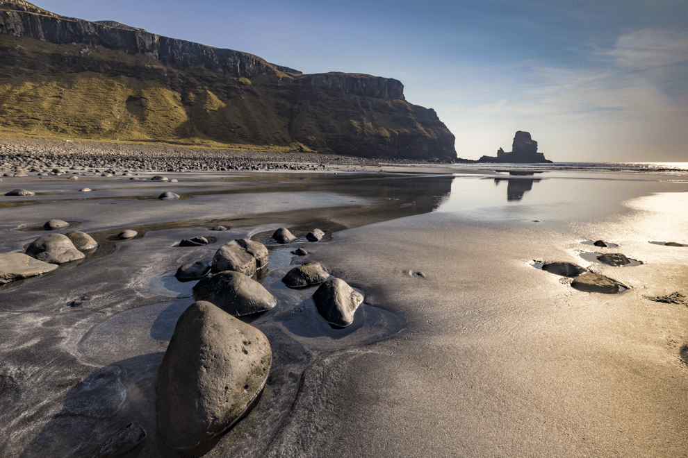
Talisker Bay
The word Talisker is well-known to whisky drinkers. Up until the last few years, the Talisker brand was the only whisky distilled on the Isle of Skye. The whisky is distilled in nearby Carbost but was named after the estate, some five miles away, that includes the Talisker Bay.
There is a gentle walk from the car park to the bay of about 1.5km which takes about 20 minutes. There are a couple of photographic interests in the bay. To the North is a tall waterfall. However, the most photographed subject are the round stones that are visible on the sand at low tide and the large sea stack on the southern edge of the bay. It’s best to plan your visit for around 90 minutes either side of low tide.
Location Co-ordinates: 57°17’0.659″ N 6°27’29.94″ W
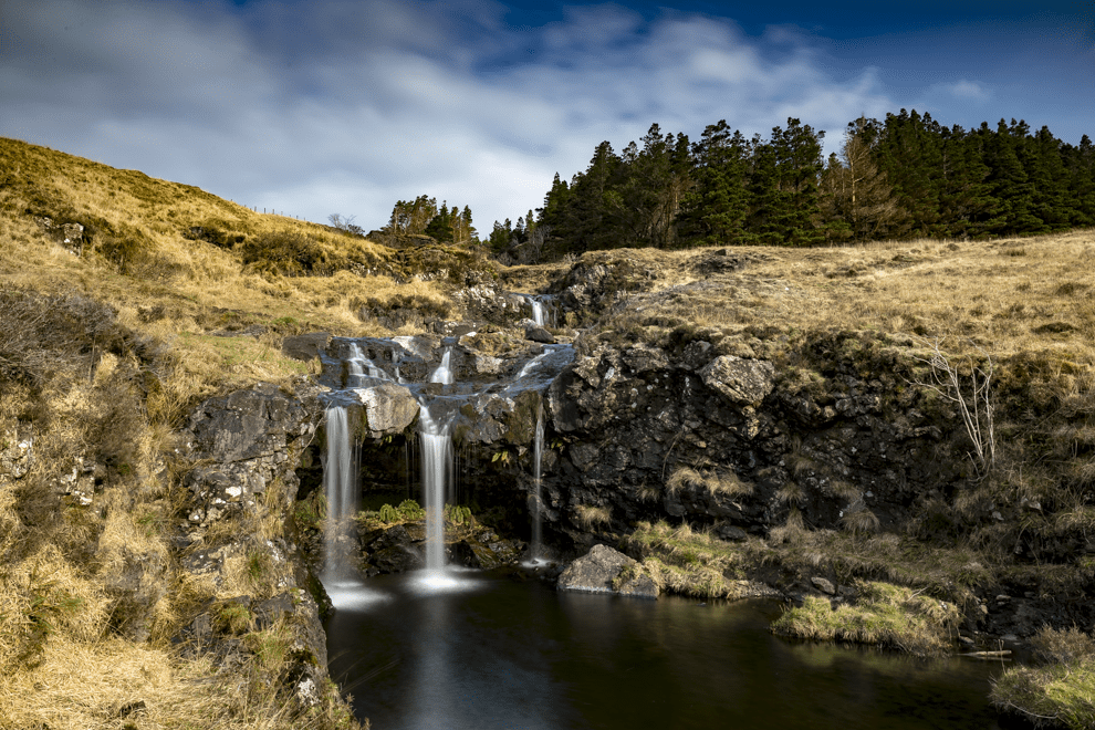
Fairy Pools
The Fairy Pools are a collection of waterfalls along the River Brittle. They are one of the most visited locations on Skye. This is because the pools are relatively easy to reach, a short walk from a Forestry Commission Car Park at the head of Glen Brittle. They are also a draw for wild swimmers who can take a dip in the clear blue waters of the river.
On the walk toward the pools from the car park, there is a small tributary flowing into the River Brittle. It’s worth taking a break here as the rest of the crowds are hurrying to the bigger falls further along the path. I would recommend wearing wellington boots or bringing waders if there has been quite a bit of rain prior to your visit as you can get some great angles by getting into the cold waters of the river.
Location Co-ordinates: 57°15’1.8″ N 6°16’9.119″ W
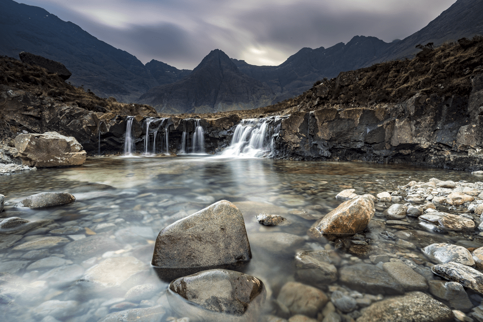
Heading along the well-marked path, there are several waterfalls with relatively easy access for photography. Again, wellingtons will get you the better angles but it will be a challenge to get a clear shot, especially on the lower falls, due to the number of visitors. If you push onwards to the falls closer to the top of the river, there will be less people. I was quite fortunate on the day we visited to have the top fall, which has the best views toward the Cuillin Hills, to myself for about 20 minutes.
To get the image below, I had to stand at the top of the next waterfall down the river behind me. Again, I was shin high in the river – this was taken after a few weeks of dry weather so be prepared for a much deeper flow if there has been bad weather prior to your visit. It’s well worth investing in a circular polariser for this scene so that you can determine if the water is going to be reflective or see-through (as I went for).
Location Co-ordinates: 57°14’54” N 6°14’34.259″ W
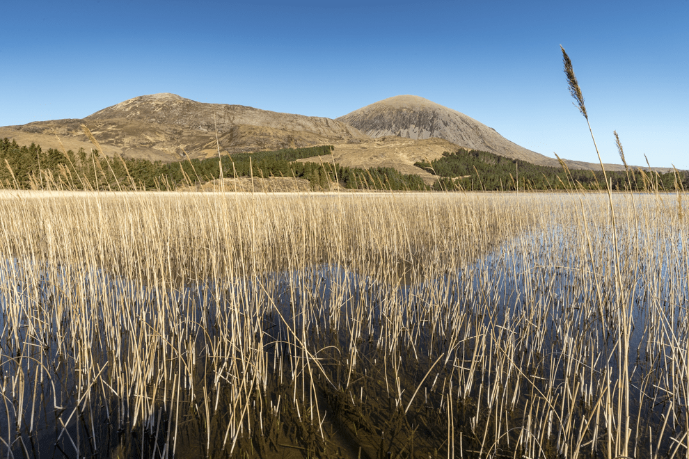
Loch Cill Chriosd
The Loch of Christ Church (Loch Cill Chriosd) is a few miles south of Broadford on the road to Elgol. The loch is sometimes known as ‘the hairy loch’ due to the large number of reeds. There is a parking spot close to the old ruined church and you can then walk toward the shore of the loch.
This location could be shot throughout the day. However, to get the mountains lit up, you should arrive mid-morning. The mountains, Beinn Dearg Bheag, Beinn Dearg Mhòr and Beinn na Caillich are all part of the Red Cuillin Hills. The Red Cuillins are made from granite as opposed to the gabbro and basalt of the Black Cullins. As a result of being made of softer rock, they tend to have rounded tops due to the glacial erosion that took place many years ago.
Location Co-ordinates: 57°12’43.74″ N 5°57’12.42″ W
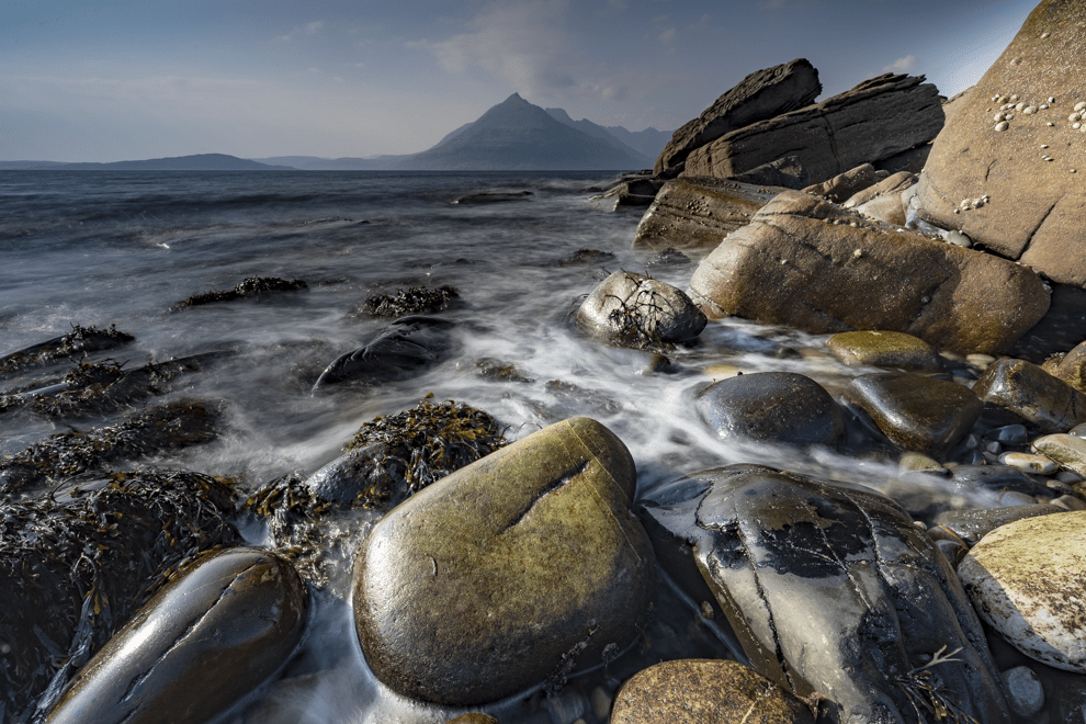
Elgol
The final location in this guide is one of the most popular sites for photography on the Isle of Skye. Elgol is a small fishing village on the shores of Loch Scavaig towards the end of the Strathaird peninsula. It is reached by continuing along the B8083 road that Loch Cill Chriosd is on. There is a car park at the bottom of a very steep hill leading into the harbour area. Due to the popularity of this area for photographers, the car park can soon fill up so it’s another location to get there early.
There are two main spots for photography. The rounded stones shown in the image below are taken by heading north from the car park. There is a path leading behind the small school which will take you to the beach. There are also good images to be had by heading south and onto the cliffs which have spectacular views to the Black Cuillins.
Location Co-ordinates: 57°8’51” N 6°6’29.82″ W
I hope you have enjoyed this short-tour of the Isle of Skye and it has introduced you to a few less photographed locations. All the images from this blog and the previous two are available to buy as framed limited edition prints. You can also subscribe to our monthly newsletter which contains exclusive content for subscribers. If you are interested in photographing the West coast of Scotland, why not join us on the West Highland Landscapes workshop between 25-27th October?