April 24, 2019
Isle of Skye – Photo Guide – Part 2
A photographers guide to some familiar and not so familiar locations on the Isle of Skye in Scotland
The first part of this location guide to the Isle of Skye concentrated on the Trotternish Peninsula. In this second part, we are going to look at the West of the island. This takes in the three areas of Dunvegan, Waternish and Duirinish as well as a final location which is on the way to the South of the island. To give a sense of scale the locations included in this part of the guide are shown on the map below.

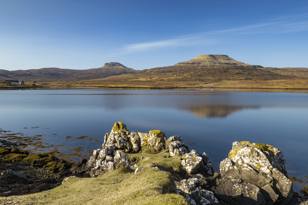
Macleod’s Tables
The Durinish peninsula is dominated by two table-top mountains, Healabhal Bheag and Healabhal Mhor. There is some doubt over what the Gaelic names mean, but it could be a translation of the Norse ‘Helgi Fjall’ or Holy Fell. They are collectively known as the Macleod’s Tables which is said to refer to a chief of the Clan Macleod who held a feast on one of the two summits in the 16th Century. He chose the location to prove to a Lowland Earl that the Isle of Skye had the biggest and best table than any other place in the kingdom of Scotland.
The shot below was taken from the shores of the loch at Dunvegan near the Kinloch campsite. As it is a west facing shoreline, the best time of the day to capture the tables from this location is in the morning. This allows the light to be hitting the two mountains.
Location Co-ordinates: 57°25’49.14″ N 6°34’55.859″ W
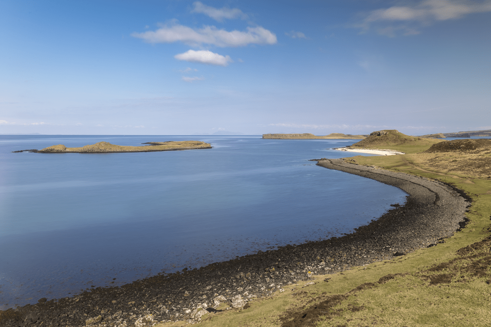
Coral Beach
Toward the top of the small peninsula that starts from Dunvegan is a small settlement called Claigan. It’s around a 4-mile drive North of Dunvegan Castle. At the end of the road is a small parking area where you can then walk for around 25 minutes to what is known as the Coral Beach.
The beach is actually badly named as the white sand isn’t really coral. It is made up crushed sun-bleached fossilised algae. The white sand helps to give the sea a tropical blue colour. On a good day, like the one we were treated to you could almost be forgiven thinking that you were on a beach in the Bahamas rather than the West Coast of Scotland!
There are two great views, the first is on the walk toward the Coral beach. From a small hill, you can show the combination of dark coloured basalt beach and the contrasting white ‘coral’ beach.
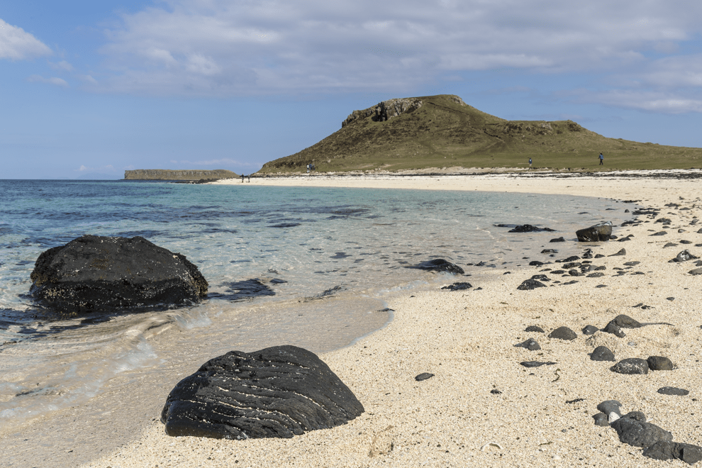
Once you have reached the white beach you can then use the sweep of the cove to show the beach in more detail. As you can see, this is a popular beach for families so it can be quite difficult to photograph the beach without anyone else in the shot.
Location Co-ordinates: 57°29’59.46″ N 6°38’10.919″ W
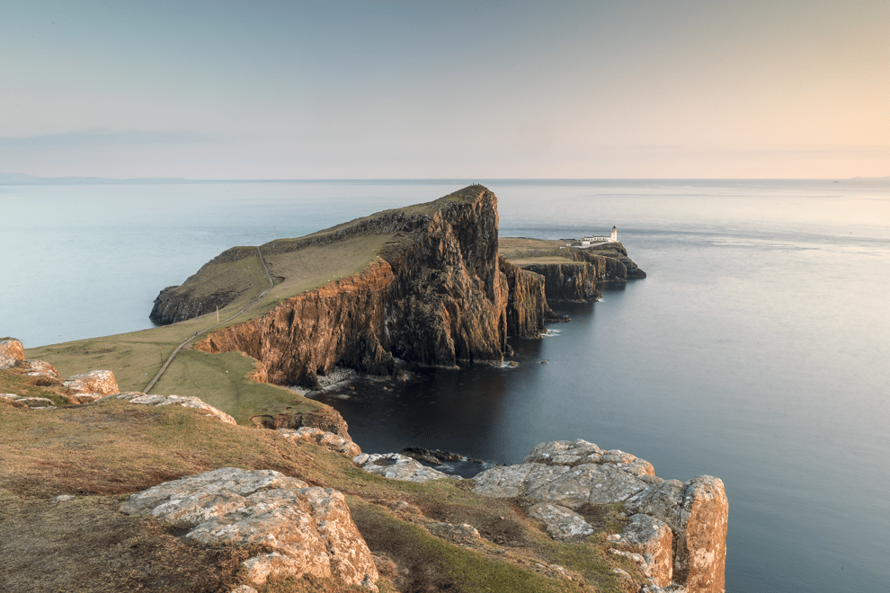
Neist Point
Neist Point is the most westerly part of the Isle of Skye. It is on the edge of the Duirinish Peninsula. At the end of the point is one of the most photographed lighthouses in Scotland. Built in 1909, and designed by David Stevenson, it provides a focal point as the basalt rocks sweep out into the Atlantic Ocean.
There is a well-marked car park which leaves a very short walk to the top of the cliffs. Do be aware though that this is a very popular site at sunset and the car park can fill up quite quickly. Arrive early or you may be left disappointed not being able to park your vehicle whilst the light is looking amazing! Also, be careful at this location when setting up – the shot below was taken at 130m above sea level so it is a long drop down from the cliffs.
Location Co-ordinates: 57°25’49.559″ N 6°47’1.02″ W
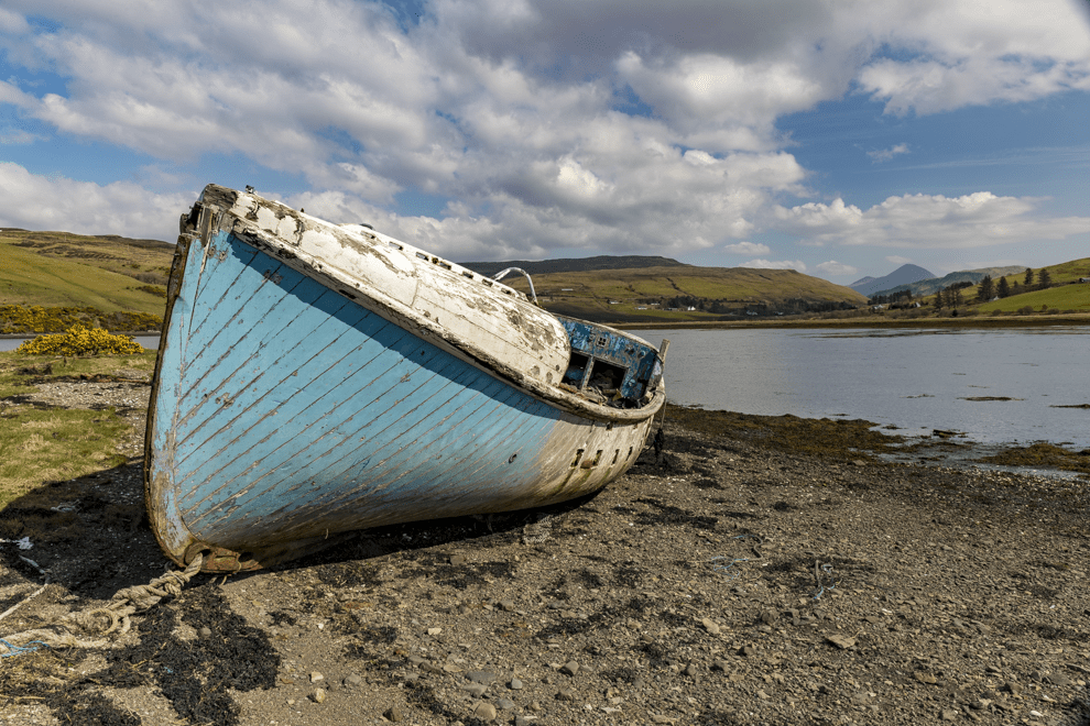
Loch Harport Boat Graveyard
The final location this week just about shoe-horns into the West of Skye. Around 30 minutes south of Dunvegan is the mouth of Loch Harport. As you turn the corner at the South of the loch there is a small cemetery visible from the road. There is a car park just outside the cemetery where you can then walk through a field to see three old boats that have been left to rot on the shore of the loch.
All three of the boats have some interest for photography. However, I liked this blue boat which is positioned so that it is possible to include the mountains through the gap in the valley at the end of the loch.
Location Co-ordinates: 57°17’52.259″ N 6°19’23.28″ W
That completes the second part of this three-part guide to the Isle of Skye. Next week we will conclude the guide with another four locations toward the South of the Isle of Skye. All the images from this blog are available to buy as framed limited edition prints. If you are interested in photographing the West coast of Scotland, why not join us on the West Highland Landscapes workshop between 25-27th October? You can also subscribe to our monthly newsletter which contains exclusive content for subscribers.